Let’s Start Work
Together
Please feel free to contact us. We will get back to you. Or just call us now.


What we do
Supervision and Management
- GTE Africa Ltd project management professionals support client’s business goals by facilitating the efficient and effective delivery of project objectives through a rigorous project management process.
- We manage and supervise project teams to ensure project scope, budget schedule, and quality parameters are met throughout the project life-cycle from germination through execution to close out.
- GTE Africa Ltd project managers are inter-nationality experienced, qualified project management professionals who exhibit a high level of expertise and skills to achieve success criteria for all project stakeholders
Engineering Surveying
- Our engineering survey services cover civil and mechanical works, including the setting ouof structures, form-work, embedded elements, finished surfaces, sub-grades, underground utilities, etc.
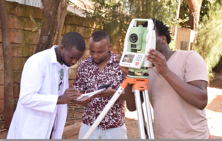
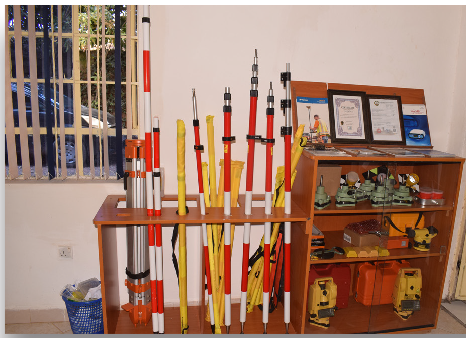
- All GTE Africa Ltd construction and engineering surveying techniques utilize digital equipment, either total stations or Real Time Kinematic GPS.
- Built-in coordinate geometry functions enable on-the-fly calculations of coordinates and levels allowing construction crews to re-position formwork, rebar, etc. quickly and efficiently.
Topographic Mapping
- “Field-to-Finish” mapping accurate and detailed maps of land topology and features.
- GPS equipment is used to provide highly accurate control points from which the remainder of the survey is based.
- Conventional survey techniques, such as Total Station, as well as GPS methods are employed.
- Ground base mapping is the most accurate method of capturing terrain and feature data for design purposes.
- Mapping of large areas at a smaller scale, requiring less accuracy, e.g. preliminary design during pre-feasibility studies, is completed utilizing non-terrestrial techniques such as aerial photography and high resolution satellite imagery.
Cadastral or Property survey
- Cadastral surveying is the discipline of land surveying that relates to the laws of land ownership and the definition of property boundaries.
- It involves interpreting and advising on boundary locations, on the status of land ownership and on the rights, restrictions and interests in property, as well as the recording of such information for use on plans, maps, etc.
- It also involves the physical delineation of property boundaries and determination of dimensions, areas and certain rights associated with properties, whether they are on land, water or defined by natural or artificial features.
- The Survey for demarcating boundaries of urban plots and rural farms/estates used to obtain legal ownership of land. GTE Africa Ltd is becoming the most prominent service provider for Cadastral Survey. Our precision, sharpness to perform quick surveys of boundaries of irregular land parcels to produce adjudication maps usually required for valuation and compensation of land properties to facilitate acquisition of land for investment purposes.
- Our clients have great customer diversity in this arena as we have forged ourselves into the cadastral survey of land measurement activity experts. We have helped our customers in their need to describe new or changed boundaries of land parcels and include recovery and restoration of lost boundaries.
- Our deliverables are in form of textual, numerical, graphical or a combination of these. The ultimate result of our works is to provide basic information of geometric descriptions (including spatial location, size and shape) of land parcels. Such information is prerequisite to successful land registration in Kenya.
- Accuracy, the degree of conformity with set standards, is observed in boundary surveys.
- Accuracy in the surveys is important because, among other things, it helps surveyors to determine equipment and methods to use. Furthermore, accurate land parcel information is a fundamental tenet of cadastral systems. High accuracy implies high cost.
Site Surveys
- An initial stage of planning a development is to remove uncertainty by accurately determining the extent of the site and detail upon the land. This can include legal boundaries, any constraints, contours, levels, and the physical position of features, including buildings, vegetation and services.
- This assists your architect design new buildings, the design of infrastructure structures, or new subdivisions, the provision of “as built” data, and determines land areas and mapping for planning purposes.
- You will have the confidence that the works are located as designed and are within the boundaries of the site. As Licensed Cadastral Surveyors, GTE Africa Ltd can provide certification that the works have been correctly set out.
- If you require a simple or detailed topographical plan, contact GTE Africa and we will be pleased to help you with your requirements.
GPS Surveying & Positioning
- Positioning of survey ground points by using GPS as per specifications for intended uses. Extension of GPS geodetic control networks to remote areas, establishment of control networks for offshore and underground surveys.
- The GPS (Global Positioning System) is a “constellation” of 24 well-spaced satellites that orbit the Earth and make it possible for people with ground receivers to pinpoint their geographic location. The location accuracy is anywhere from meters to millimeters.
- GPS Surveying solutions use the GPS Satellite System for commercial use to enable surveyors to accurately locate points on the earth surface. These systems are widely used to enable the accurate mapping of physical features on the earth surface and monitoring deformation as well as plate tectonic movement on the Earth.
- With the increase in accuracy, reliability and ease-of-use, GPS methods are becoming the standard technique applied to the positioning of structures in both land and marine environments.
- GTE Africa Ltd has the capability to position structures in real-time, using Real Time Kinematic (RTK) techniques, and to verify existing structures or prepare “As-built” drawings using RTK or post-processed GPS methods.
Uses for Surveying and Mapping are:
- Detail survey for topographic features e.g. roads, manholes, pipeline, power lines, buildings etc.
- Establishment of Control Points for mapping purpose.
- Establishment of High Order Framework
- Scientific measurement for determination of Geoids computations.
- Engineering Staking Out.
- Guiding the heavy plant equipment during construction phase.
- Deformation Monitoring.
Geodetic Control Surveys
- Survey control networks are the fundamental foundation to support any project from building construction, deformation monitoring, to the national survey network for legal boundaries, geographical information and mapping.
- GTE Africa Ltd designs, installs and coordinates control network systems for a wide variety of civil engineering and mapping projects.
- As GPS has become the standard method of cost – effectively coordinating new control points, GTE Africa regularly uses GPS in both static and RTK modes to quickly and accurately establish control point networks.
Precise Land Measurement
- There are times when your land and features upon may need to be located. Knowing the exact position, level or dimensions of features means any future planning and design can be completed with confidence and remove any uncertainty.
Boundary Location and Reinstatement
- Whether constructing new buildings, erecting new fencing, selling a property, setting out covenant areas, or disputing a boundary, only a Licensed Cadastral Surveyor is legally empowered to define the boundaries.
- Various options are possible including locating existing boundary pegs, a complete boundary reinstatement (monumentation) survey, providing Certification of the siting of buildings within boundaries, marking of boundary alignments or providing boundary offset marks.
- All the options can be discussed and are dependent on the purpose and any legal issues involved.
- Knowing the exact location of your boundaries will help avoid expensive encroachment disputes and possible disputes with your neighbor’s. It will also give buyers confidence in a purchase.
- GTE Africa Ltd can assist to resolve existing boundary problems, confirm the correctness of existing boundary marks, replace pegs, advice regarding boundary disputes and possible remedies, and prepare legal survey data to document the location of your boundaries.
